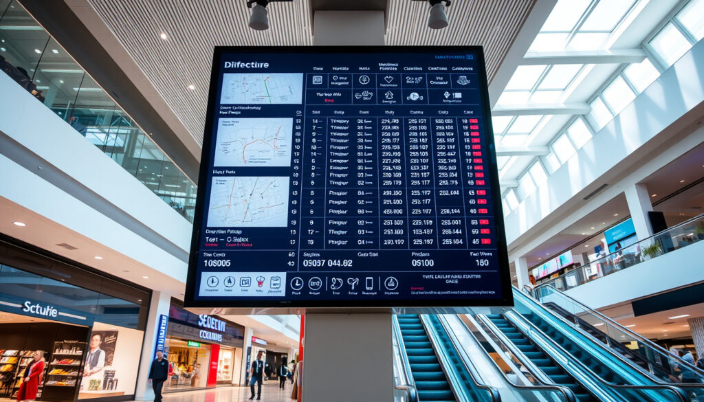
Westfield Chermside Directory: Shops, Map, Food & Phone
If you’ve ever wandered a sprawling shopping centre without a plan, you know the drill — circling back past the same stores, giving up on finding that one specific shop, or settling for whatever’s closest to the food court. Westfield Chermside makes that scramble unnecessary. As Brisbane’s second-largest shopping destination, the centre packs more than 500 stores across four levels, which means a solid directory is less a luxury and more a survival tool.
Location: Brisbane, QLD · Official Site: westfield.com.au/chermside · Stores: 515 · Anchor Tenants: 10
Quick snapshot
- 515 stores and services across 4 levels (Westfield Chermside Map PDF)
- Trade area covers 901,400 residents as of 2024 (Westfield Chermside Trade Area Map PDF)
- Centre opened 31 May 1957, purchased by Westfield in 1996 (Westfield Chermside Map PDF)
- Total store count varies between sources — 451 to 476 specialty stores cited
- PDF map update dates not confirmed beyond 2025 reference
- Individual store phone numbers not compiled in a single directory
- Centre map with level-by-level directories (Westfield Chermside)
- Online browse-stores page with category filtering (Westfield Chermside Stores)
- Food and drink directory with 50+ dining options (Westfield Chermside Food & Drink)
- New dining concepts periodically added — Bavarian Lunch Klub recently opened (Westfield Chermside Dining)
- Trade area reviewed 2023 using transaction data (Westfield Chermside Trade Area Map PDF)
The table below consolidates the centre’s core specifications from official Westfield documentation.
| Attribute | Value |
|---|---|
| Name | Westfield Chermside |
| Type | Shopping centre |
| Location | Brisbane, QLD (approx. 10 km north of CBD) |
| Total Stores & Services | 515 |
| Anchor Tenants | 10 |
| Retail Floor Area | 175,553 m² |
| Parking Spaces | 7,300 |
| Opening Date | 31 May 1957 |
| Floors | 4 |
| Map Available | Yes, level-by-level PDF and interactive online |
Westfield Chermside directory shops
The store directory at Westfield Chermside spans 515 stores and services, placing it among the largest retail destinations in Queensland. The official browse-stores page on the Westfield website breaks these down into browsable categories including fashion, beauty, electronics, home, entertainment, and services. This organizational structure means you can filter by what you actually need rather than wandering level by level hoping for the best.
Browse stores list
Rather than relying on memory or a vague gut feeling about where a store might be, the directory gives you a searchable list with store names, locations, and sometimes contact details. The full store directory lets you type in any retailer by name. For instance, a query for “2 Brothers Traditional Barber” surfaces the store directly with its location reference — no guessing whether it’s on the ground floor or buried in the wing.
For bargain hunters and mission-specific shoppers, the directory’s category filters alone can cut 20–30 minutes off a typical visit — that’s the difference between a quick run and a half-day commitment.
Key store categories
Major anchor tenants anchor the layout at Westfield Chermside. According to the official centre map PDF, these include David Jones (occupying two levels), Myer (three levels), Harris Scarfe, BIG W, Kmart, Target, Coles, Woolworths, the Apple Store, and Event Cinemas with its 16-screen complex featuring VMAX and Gold Class screens. Beyond the anchors, mini-majors like Best & Less, JB Hi-Fi, and Rebel Sport cluster in their own zones, so once you know which type of store you’re after, you can head straight to the relevant section rather than scanning every storefront.
The directory categorizes specialty stores by their retail type. Fashion outlets sit alongside beauty retailers like Sephora and Aesop. Homeware options include Adairs. Electronics spans JB Hi-Fi and the Apple Store. Services cover everything from barbers like 2 Brothers Traditional Barber to travel agents and optometrists. The categorization makes it straightforward to narrow down a search before you even step through the doors.
The Scentre Group (owner and manager of Westfield Chermside) reports the centre serves a trade area of 901,400 residents as of 2024 — that population size explains why the directory needs to handle 515 individual listings without becoming unwieldy. The categorization system exists precisely because a centre this size would overwhelm anyone trying to browse it without a plan.
Westfield Chermside directory PDF
The most complete physical reference for Westfield Chermside comes in PDF form. The official centre map PDF from Westfield documents the full layout, anchor tenants, mini-majors, specialty store counts, and even the trade area population data. This isn’t a promotional brochure — it’s the operational reference document that also contains historical context like the centre’s opening date of 31 May 1957 and Westfield’s 1996 purchase.
Shopping centre map PDF
The PDF map breaks the centre down by level, showing which stores occupy each section. For those who prefer a physical copy — or want something to annotate — downloading the PDF before visiting can replace a significant portion of aimless wandering. The map also includes parking zone designations and the integrated bus station location, which the Wikipedia entry on the centre notes has been part of the layout since opening in 1957.
- Level-by-level store directories
- Anchor tenant locations with floor assignments
- Parking zone references
- Bus station integration
- Trade area and demographic data
Download options
Beyond the main map PDF, a 2025 trade area map PDF provides additional context on the population the centre serves. Both documents come from official Westfield sources — the Scentre Group’s operational data rather than third-party interpretations. For anyone researching the centre’s scale or planning a visit based on trade area reach, these PDFs represent the most authoritative available references.
Westfield Chermside directory map
If the PDF is the static option, the online interactive centre map is the real-time alternative. The web-based map lets you navigate level by level, zoom into specific sections, and locate individual stores without downloading anything. For smartphone users — which is most visitors — this tends to be the more practical option on the day of a visit.
Level by level store map
The centre spans four levels, and the map makes clear which stores sit on each floor. Ground level hosts the major supermarkets (Coles and Woolworths) alongside fashion anchors. Upper levels carry the department stores — David Jones across two floors, Myer across three — while the entertainment precinct “The Street” (noted in the Wikipedia entry as the first of its kind in Queensland for Westfield) occupies its own zone. The map allows you to select a level and see every store on that floor, which answers the common question “is this store on the same level as the cinema?” before you ask a staff member.
Facilities and amenities
Beyond retail locations, the centre map documents amenities the directory might otherwise miss. These include the information kiosks (where physical directories are available), parent rooms, accessible toilet facilities, and the parking entry points. The PDF map notes 7,300 parking spaces across designated zones — useful context if you’re driving and want to park near your first target store rather than circling for the nearest spot.
The centre homepage also flags what’s new — seasonal openings, pop-ups, and recently added dining options. The directory as a whole is therefore a living document: the PDF provides the structural backbone, while the website and app layers show what’s changed since the PDF was last updated.
Westfield Chermside directory food
Food and drink options at Westfield Chermside number over 50, according to the official food and drink directory. This isn’t a single food court block — restaurants, cafés, and quick-service outlets spread across all four levels, which means your lunch destination depends heavily on where you’re shopping when hunger hits.
Dining options
The dining precinct mixes chain staples with specialty operators. Chain options include KFC, McDonald’s, Nando’s, Starbucks, Subway, and Boost Juice. Specialty operators cited in the official directory include Bake N Grill Vietnamese Bakery, Bapboi Korean BBQ, Betty’s Burgers, Grill’d, Guzman Y Gomez, Sushi Hub, and Wara Sushi. The dining page also lists Zeus Street Greek, The Coffee Club, Hong Kong Lane, and the recently added Bavarian Lunch Klub.
The breadth of dining options means you won’t be settling for the only available option — but it also means the food court area gets crowded fast during lunch hours (roughly 12:00–13:30 on weekdays). If you’re visiting specifically to eat, arriving before noon or after 14:00 typically means shorter queues and more seating availability.
Food court details
The formal food court sits within the centre’s dedicated dining zone, but the centre map PDF confirms that restaurants and cafés spread across all four levels rather than concentrating solely in the food court block. This distribution means fine-dining options like the restaurants on the upper levels sit apart from the quick-service food court — you can choose between a 15-minute lunch and a sit-down meal without crossing to a different part of the centre.
For visitors planning their day around meals, the food directory provides hours and sometimes contact details for key restaurants. The directory guide from House of Isabella notes that the online directory supports smartphone browsing for real-time availability and directions, which means you can check whether a restaurant is open and get walking directions to it mid-visit.
Westfield Chermside directions
Getting to Westfield Chermside is straightforward by car, bus, or rideshare, but the specifics matter if you’re planning logistics in advance. The centre sits approximately 10 kilometres north of the Brisbane CBD in the suburb of Chermside, coordinates roughly 27°23′00″S 153°02′00″E. It has operated an integrated bus station since opening in 1957, which remains a key advantage for public transport users.
Getting to the centre
By car, the centre is accessible from Gymbow Road and the surrounding Chermside road network. The official website provides driving directions through the centre’s location page. With 7,300 parking spaces documented in the official map PDF, parking availability is rarely a problem outside peak pre-Christmas periods — but the parking zones are large enough that knowing which entrance corresponds to your target store helps avoid a long walk from the car.
By bus, the centre’s integrated bus station means multiple routes drop you directly at the shopping centre rather than at a nearby street corner. This is a meaningful advantage over centres that require a 10-minute walk from the nearest bus stop. Brisbane Transport route planners integrate Westfield Chermside as a destination, so checking your journey before leaving home typically gives accurate arrival times.
The trade area data from the official trade area map shows the centre draws from a 901,400-resident catchment — the largest in its immediate region. That scale means weekend traffic to and from the centre can be heavy, particularly between 10:00 and 15:00 on Saturdays. Mid-week morning visits typically offer the smoothest driving and parking experience.
Contact phone number
Individual store phone numbers aren’t compiled in any single directory — a gap worth noting for anyone who wants to call ahead before visiting. The centre’s main contact information appears on the official homepage, but store-specific directories require searching individual store pages on the Westfield website or using the app. The third-party directory guide from House of Isabella notes this limitation, recommending the Westfield app for real-time contact details and directions.
How to use the Westfield Chermside directory
The directory tools available — PDF maps, online centre map, browse-stores page, food and drink directory, and the mobile app — each serve different purposes depending on when you’re using them.
- Download the official centre map PDF for the structural overview before your visit.
- Search the store directory for specific retailers you need to visit.
- Check the food directory if dining is part of your plan.
- Open the interactive centre map on your smartphone for real-time navigation during your visit.
- Use the app for contact details if you need to call a store mid-visit.
Before your visit
- Download the official centre map PDF for the structural overview
- Search the store directory for specific retailers you need to visit
- Check the food directory if dining is part of your plan
- Note the trade area data if you’re researching the centre’s regional significance
During your visit
- Open the interactive centre map on your smartphone for real-time navigation
- Use level filters to confirm which floor your target store is on
- Check the homepage for new store announcements
- Use the app for contact details if you need to call a store
Westfield Chermside: confirmed facts vs. what’s uncertain
The official sources establish a strong factual baseline for Westfield Chermside, but gaps remain between what the directory documents and what visitors often want to know.
Confirmed
- 515 stores and services, 10 anchor tenants, 4 floors, 175,553 m² retail floor area
- Trade area population of 901,400 (2024 figure, reviewed 2023)
- Opened 31 May 1957, purchased by Westfield 1996, stage 2 redevelopment 2000
- Official site provides store directory and centre map
- Food and drink directory lists 50+ dining options
- 7,300 parking spaces across designated zones
Unclear
- Exact specialty store count varies: 451 to 476 across different sources
- Individual store phone numbers not compiled in any single directory
- PDF map update dates not confirmed beyond 2025 references
- Post-2025 new store openings not comprehensively documented
The pattern here is that the centre’s owner (Scentre Group) publishes reliable data on overall scale and anchor tenants, while granular details — per-store contact numbers, exact specialty counts, recent openings — fall to individual store pages or aren’t centralized at all. For visitors who need specifics, the app and individual store pages remain the most current sources, but no single directory collects all that information in one place.
“Westfield Chermside is home to David Jones, Myer, BIG W, Kmart, Target, Coles, Woolworths, Apple, an Event Cinemas complex and approximately 451 specialty stores.”
“The Chermside Westfield directory is a comprehensive guide listing all the stores, services, and facilities available at Westfield Chermside.”
Related reading: Queen Victoria Building Sydney Guide · Kmart Bath Mat Review
Shoppers exploring Westfield Chermside’s 515 stores will find the flagship David Jones Chermside guide particularly useful for its hours, location and parking tips.
Frequently asked questions
What is Westfield Chermside?
Westfield Chermside is a regional shopping centre in Brisbane, Queensland, located approximately 10 kilometres north of the CBD. It is the second-largest shopping centre in Brisbane with 515 stores and services, 10 anchor tenants, and 7,300 parking spaces across four levels. The centre opened 31 May 1957 and was purchased by Westfield in 1996.
How do I find a specific store at Westfield Chermside?
Use the browse-stores page on the official Westfield website to search by store name. The directory provides location references and, for many stores, contact details. Alternatively, use the interactive centre map to navigate level by level on your smartphone while visiting.
Is there parking at Westfield Chermside?
Yes. The centre offers 7,300 parking spaces documented in the official centre map PDF. Parking zones are designated, and the integrated parking areas surround the main centre building with entry points from Gymbow Road and surrounding streets. Parking availability is generally good outside peak pre-Christmas periods.
What time does Westfield Chermside open?
Standard trading hours are listed on the official Westfield Chermside homepage. Major anchor tenants like David Jones, Myer, and the supermarkets may have their own operating hours within the centre. It is worth checking individual store pages if you’re planning an early or late visit around a specific retailer.
Are there events at Westfield Chermside?
The centre periodically hosts events, seasonal activations, and new store openings. The homepage and app typically surface what’s currently on. The entertainment precinct “The Street” (the first of its kind in Queensland for Westfield, per the Wikipedia entry) provides a dedicated space for community events within the centre.
How to shop online from Westfield Chermside stores?
The Westfield website and app provide online links for participating retailers. Individual store pages on the browse-stores page sometimes include direct online shopping options. Note that not all stores offer online purchasing through Westfield’s platform — some redirect to the retailer’s own website.
What transport options to Westfield Chermside?
By car: approximately 10 kilometres north of Brisbane CBD via major roads, with 7,300 parking spaces on-site. By bus: the centre has an integrated bus station operating since 1957, accessible via multiple Brisbane Transport routes. By rideshare: drop-off points are available near the main entrances. The official website provides driving directions for those coming by car.
For Brisbane shoppers and visitors, the directory is the practical entry point to a centre that otherwise rewards planning over improvisation. Whether you’re driving in from the outer suburbs or taking the bus from the CBD, knowing what’s there before you arrive turns a massive retail space into something navigable — and that’s the whole point of having a directory in the first place.
More related posts
 Justin Rose: Wife, Children, Net Worth, and Golf Career
 Best NBN Internet Plans: Compare Broadband Deals & Providers
 Rudolf Hess: Latest Verified Information and Unanswered Questions
 Eartha Kitt: Biography, Ethnicity, Accent, Death & Daughter
 Kmart Garden City: US Closure, AU Locations & History
 LFT Blood Test: What It Includes, Results, and Next Steps
 Gabriel Iglesias: Net Worth, Tour & Why Mr. Iglesias Was Canceled
 Frances McDormand Oscar Wins: Biography & Personal Life